Stanley Nut

|
Stanley Nut Bimble
   We have a slack morning before we leap
into action. We leave Mabel, bimble through the campsite, through Stanley to the
chair lift. Here we have to stand ready on the
pictures of feet, the chair scoops us up and a lady whips the handle bar over
our heads into position. We’re off, below us a tiny wallaby is unconcerned as to what a pair of tourists
have planned.
 More than thirteen million years ago in a
burst of volcanic activity, lava poured out in this vicinity through a crack in
the crust of the earth’s surface. It then solidified into a thick layer of
course grained basalt known as Teschenite.This was
the beginning of the formation of the prominent feature known as The
Nut.
   A very pleasant ride
up, time to try a selfie, the station at the top.
Stanley Visitor’s Centre Says:
The Nut was first called Circular Head when it was discovered by Bass & Flinders in 1798. The region that surrounds the Nut has since been called Circular Head. It depends who you talk to on the origin of the name the Nut. Some say it is a shortened version of the Aboriginal name for it which was Moo-Nut-Re-Ker. Some also say the name came from when the breakwater was built in 1892. The side of the Nut was packed with explosives to construct the breakwater, once detonated nothing happened and no rocks fell from the side of the Nut. Apparently most of the crowd that gathered to watch the event, agreed that is was a “Hard Nut to Crack”.
We set off to do the Nut Circuit. The Nut was acquired by the Tasmanian Government and proclaimed a State Reserve effective from the 2nd of December 1980. The Nut stands 143 metres in height and covers and area of just over 146 acres. An important aspect of The Nut is its use by migratory birds, the short-tailed shearwater, the rare orange bellied parrot, the black-eared cockatoo [previously unsighted in Tasmania has been seen in recent years. Infrequent visitors are the Nankeen kestrel and peregrine falcon. Silver gulls nest in safety close to the cliffs and on the low slopes many fairy penguins call The Nut home. Maintenance a constant battle against pesky gorse and these chaps are dressed and armed for the challenge.
We follow the track anti-clockwise.
 
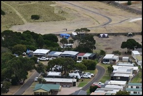
Highfield Lookout. Bear with our campsite behind him. Zoomed in, our campsite still looks huge. Mabel is this side of the blue tarpaulin at the far end of the site.
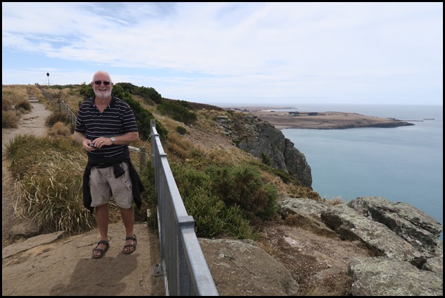
Tatlows Beach Lookout. We watched a boat towing a couple of doughnuts, one occupant fell out and stood up in water just over knee deep, what a fantastic beach to bring little ones to learn to swim, kayak, dinghy sail and so much more, needs to be a bit warmer for us though.
We follow the track downward into a deeply wooded area. Watching the wallabies and with no view, we quite forgot we were up on The Nut. On we went.
Fisherman's Wharf Lookout.
We sit at what we think must be the half way point and enjoy the solitude and a juice. Looking to our left and right, back the way we had come.
If we were standing in Mabel, looking toward The Nut, this view would be directly behind. From here to the little black marker at 143 metres showing the highest at Stanley Trig Point.
Circuit complete, we go into the ‘shed’ full of pictures, a map and information.
An early description of what the original vegetation of The Nut looked like comes from Mrs Rosalie Hare. Setting down her first impressions of The Nut in 1828, she wrote, “Here were plenty of trees..... of Stringy-bark, so called from their bark continually falling off and hanging in strings. I ascended it in company with the surgeon without much difficulty. We found sheep grazing on its summit and kangaroo leaping about in all directions.”
So within fifteen months of the first European settlement, sheep were already altering the landscape forever. By 1858, photographs show a few scattered trees, still standing on the summit, and many more felled and rolled down the slopes to serve as firewood for the townspeople, ‘pathetic relics’ as described by one botanist. The stringybarks that Mrs Hare described, eucalyptus obliqua, and other eucalypts such as manna gum [eucalyptus viminalis] all but disappeared from Stanly peninsula.The Nut formed part of the 20,000 acres granted to the Van Diemen’s Land Company for their wool-growing enterprise. The land was used for sheep grazing from the 1820’s right up until the mid 1990’s. As a consequence of grazing and other farming activities, weeds were introduced to The Nut. Sorrel had become a nuisance to farmers by 1860. But ironically, it was when grazing ceased that weed infestation became a major problem. One particular weed – gorse - took a firm grip on The Nut, progressing from small patches visible in the 1950’s to thickets a metre high in the 1980’s, it looked set to take over completely. Enter the Nutters.
People Power: Members of the Circular Head Aboriginal Corporation kicked off a major revegetation project in 1994 with a number of working bees to clear gorse from the shearwater colony on The Nut. The group of people involved became known as the Nutters. This group later evolved into the Stanley Peninsula Land and Coastcare Group, working with government agencies such as the Parks and Wildlife Service, community groups and local businesses to overcome weed infestation by restoring native vegetation to The Nut. The facts and figures tell just part of the story:
Well Done The Nutters.
     We not too shocked to read that these shearwaters are
harvested for their flesh, down and oil as the same thing happens in the islands
around Stewart Island, New Zealand.
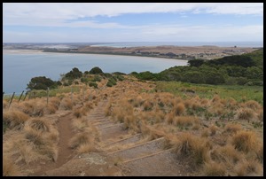
We take on the zig-zag track going down from The Nut.
The first zig....... I had to put my flip flops into 4wd. This is achieved by flicking each of them on each stride so they land just ahead me, thus the web between my big toe and the second land half an inch back from the thong, a successful manoeuvre employed in the Galapagos and Mount Yasur ensuring no damage to me and stopping my thong from getting stretched and baggy. Now no one wants a baggy thong. Steady.....
Half way. Bench for rest stop. We could see the Star of the Sea Church.
The Nut seen from Highfield House, our first stop in the morning. ALL IN ALL SMASHING DAY AND
GREAT RESPECT FOR THE PATH MAN
LOVELY TO HAVE A LIE-IN THEN A NUT
BIMBLE |


