Matheson to Wharariki Beach
Position 40 30.518S 172 41.170E It’s a very windy up hill down hill road to Wharariki. This is Hope saddle lookout trig station.
What is incredible is that this hill is all gravel, called the Moutere gravel, and deposits are 2 kms deep in places. Built up layer after layer over millions of years from a type of sandstone called greywacke eroded from the Spencer muntains. They form a ridge here between the Buller and Motueka rivers. Three million years ago most of this area (the Nelson region) was relatively flat. Tectonic plates shifted and the Spencer mountains began to form. The north-flowing rivers eroded the developong mountains and deposited huge greywacke gravel fans over the entire region, creating a plain that ran down to the Tasman Sea. The climate cooled and glaciers started to scrap out the gravel. About a million years ago another period of uplift occurred, more material was eroded off the mountains and added to the existing gravel beds. Some great views from th lookout, unfortunately don’t really come out.
In 1989 the Tasman Accord was signed protecting native forest. Basically government, conservation groups and businesses agreed to end the loging of native forest on crown land and formerly protect more that 30,000 hectatres of native forest in New Zealand. Various other bits of land have been added since 1989. Thia is Paul looking annoyed because I keep chatting to him whenever he tries to make a video….
Passing lots of grazing land.
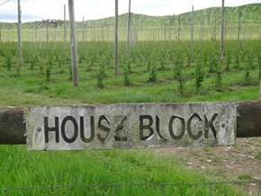
And suddenly we are into fruit in a big way .. raspberries and something we have not seen in a long, long time, hop fields.
Lots of other fruits, apples, kiwis etc. and wine…
Grouse has taken over huge areas, although the green conifers poking through look kinda nice….
You see these tin buildings all over the place, barns and animal shed mostly.
A bit of the view from Hawkes Hill lookout on Takaka Hill, a massively windy road. Now on limestone.
According to Maori legend there was a horrible lizard-like creature, Te Ngararahuarau, who thought only about eating men and enslaving women. He caught a woman called Ruru, but she was too clever for the lizard and she lulled him into sleep and then escaped the cave where she’d been enslaved. The people of the region helped her to set a trap luring the lizard to their camp and setting him on fire. He fled, and at the top of Takaka Hill, tried to dig his way home, but unfortunately he burnt to death. His charred scales turned to stone and were scattered around the hills. And the limestone does look a bit like lizard scales…
View going down the other side of the hill towards Takaka township.
Spent most of the day in the car driving to Wharariki Beach which is near Farewell Spit right at the very western tip of South Island. New campsite run by hippies. Had to pay extra for power and then extra for showers. Not amused. Pit toilets that really stank and the sand flies. I took the bug spray in with me, was just about to sit down and noticed them all flying up out of the pit. Ugh… |